I love
this village. It's so ancient, has so much energy. The
stone houses have roofs lined with firewood, and many buildings, including
the Red House lodge where I'm staying, have interior horse stables.
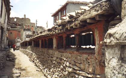
A row
of Tibetan prayer wheels divides the road to the northern edge of
town. They
bear gold writing depicting the oft-repeated mantra "Om Mani Padme
Hum", Tibetan for "Hail to the Jewel in the Lotus", the jewel being
the Buddha. Following tradition, I pass with the wheels on my
right, spinning each wheel as I pass to release the mantra to the
heavens.
A police
checkpoint sits at northern edge of town, and just beyond it a sign
reads:
STOP
YOU
ARE NOW ENTERING THE RESTRICTED AREA OF UPPER
MUSTANG. BEFORE PROCEEDING FURTHER, YOU MUST REGISTER
AT THE POLICE CHECK POST AND THE ANNAPURNA CONSER-
VATION AREA PROJECT INFORMATION CENTER. UNREGISTERED
ENTRY OF UPPER MUSTANG IS ILLEGAL.
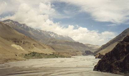
Beyond
these yellow letters of warning, the Kali Gandaki River continues
north along its narrow, dry season course along the broad, flat valley.
The Nepalese
government allows less than a thousand foreigners a year into the
Upper Mustang, an area they want to keep pure from the ravages of
modern civilization.
The
Upper Mustang
In the
forbidden distance, Nepalese carry large packs of supplies over the
rocks, crossing the river's meandering course here and there at temporary
wooden bridges, following an ancient trading route. Some lead
donkey trains, the sound of donkey bells a familiar, welcome clink
of metal.
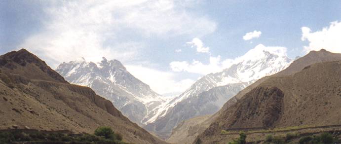
Towering
to the south of Kagbeni is a long, rocky, snow-covered ridge that
works its way up to Nilgiri Mountain. The clouds that struggle
to cross the peak are some 14,000 feet above my head. It's late
morning, and the winds from the south, fed by the colossal heights
of the Annapurnas on one side of the valley and Dhaulagiri on the
other, continue to build.
I wander
through town down narrow streets. Stone houses crumble away
and reform.
Alleys
that seem sure to end continue on,
twist
and turn,
pass
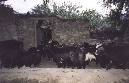
a stable where young goats bleat for attention,
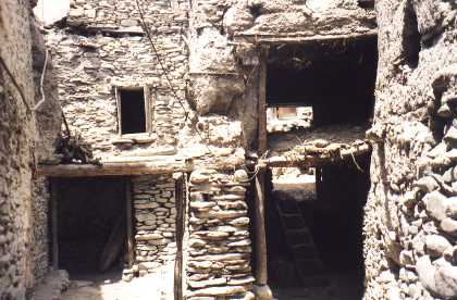
pass under
a room of a house,
and
finally open up into a courtyard.
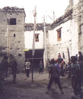
The way
of life is so calm, broken only by the afternoon winds and the incongruous
wires from a failed wind power project.
To the
east, Thorung La, a 17,769-foot mountain pass, appears as a gentle
dip between two snow-covered peaks.
Trekkers
attempting the Annapurna circuit, which typically involves circling
the Annapurnas in the opposite direction I'm travelling, must cross
this pass to complete their trek. Some have to turn back because
of altitude sickness. The barren hillside leading towards the
pass is split by the white line of the trail that travelers and pilgrims
use to make the steep ascent to Muktinath.

|